Kennewick, WA
Saturday, April 18, 2026
No reviews yet
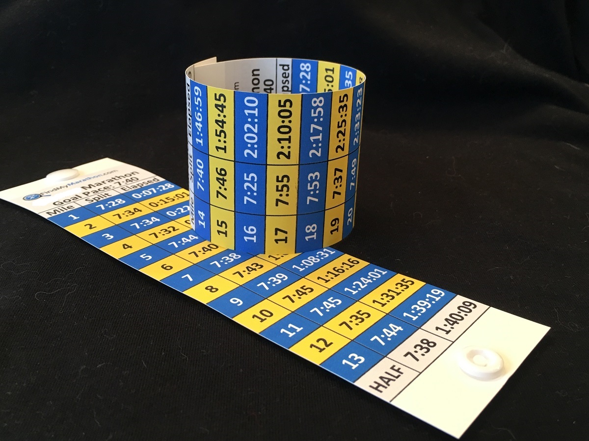
Don't waste months of training only to run the wrong pace.
Run the River Marathon Pace Bands are adjusted for the specific terrain of the course, your goal time and pacing strategies.
Only $9.99
Race Dates
2027: TBDCourse Information
Profile: Mostly FlatRace Day Weather
Mean Temp.: 52°F (11°C)PR Score & Course Score
PR Score: 99.11Race Size
2026: 161 FinishersBQ Percentages
2026: N/AMiscellaneous Information
Pace Groups?: No
Race Day Temperatures |
High: 70°F (21°C) |
Race Start Conditions |
49°F (9°C) |
PR Score |
99.27 |
Course Score |
99.27 |
The Run the River Marathon was the 327th largest marathon in the U.S. in 2025 based on the number of finishers. In 2024, it ranked as the 396th largest marathon in the U.S..
The Run the River Marathon has a Course Score of 99.27, ranking it as the 173rd fastest marathon course in the U.S. and the 16th fastest marathon course in Washington.
Typical race-time temperature and humidity levels are slightly above the ideal range for optimal marathon performance. Combined with the course profile, this gives the Run the River Marathon a PR Score of 99.11. The PR Score ranks the Run the River Marathon as the 145th best marathon in the U.S. for running a Personal Record (PR) and the 15th best marathon for a PR in Washington.
Together, these rankings provide a quick snapshot of how the Run the River Marathon compares with other marathons in the U.S. and Washington for speed, PR potential, Boston Marathon qualifying success, and overall participation.
Max Elevation: 432 feet (131m)
Min Elevation: 343 feet (104m)
Elevation Gain: 337 feet (102m)
Elevation Loss: 337 feet (102m)

Course updated 02/13/2025
View available accomodations around the Run the River Marathon Finish Line and Course. Book your Reservation now before the best places are sold out.
For a better mobile or desktop experience:
Use tools below to compare races and convert times across courses.
Do you want to see how the Run the River Marathon stacks up against other marathons?
Compare the details of the Run the River Marathon side-by-side with other marathons with our Comparison Tool.
If you ran the Run the River Marathon in 3:20:00, what would your time in other marathons be?
See how your finish time would compare on other marathon courses with our Time Conversion Tool.
