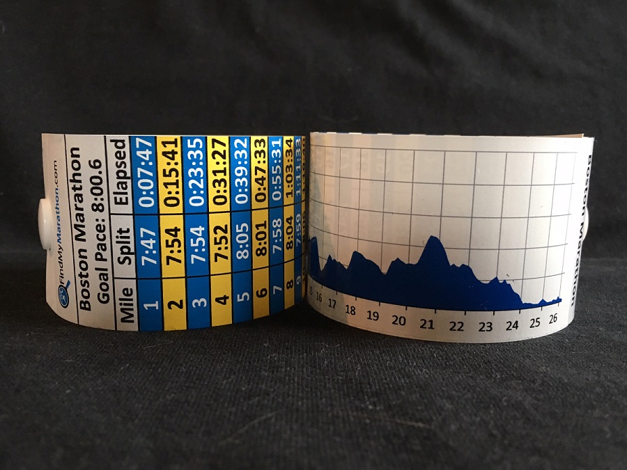


Compare two marathons side-by-side: course difficulty, elevation, typical race-day weather, finishers, BQs, and runner reviews—so you can choose the right race for your goals.
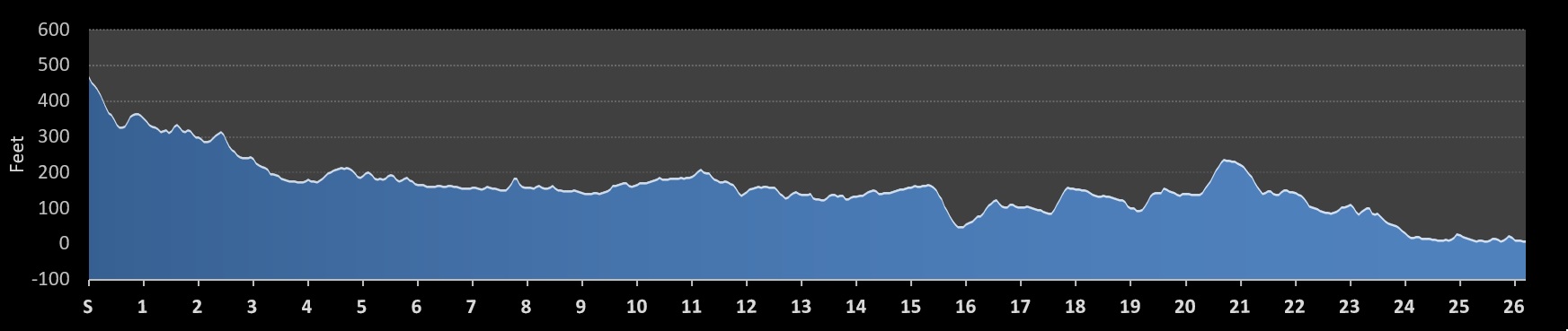
The Boston Marathon is a historic point-to-point road race that follows a net-downhill but challenging route through eight Massachusetts cities and towns. While the course features a total elevation drop of 459 feet, it is widely considered one of the most difficult major marathons due to its quad-punishing opening descents and a series of late-race climbs.
The race begins in Hopkinton and travels northeast toward the finish line on Boylston Street in Boston. The terrain is entirely paved asphalt, primarily following Route 135 and Route 16. The layout is relatively straight for the first 25 miles, with only one turn (at the Newton fire station) until the famous "Right on Hereford, Left on Boylston" sequence in the final half-mile.
The elevation profile is characterized by extreme undulation, divided into three distinct phases:
Because of the net-downhill drop, the Boston Marathon is not eligible for World Records, and its PR potential is heavily dependent on the wind and weather. A strong tailwind from the west can lead to fast times, while a headwind off the Atlantic can make it significantly harder. PR attempts often fall apart in the Newton Hills if a runner does not conserve energy during the opening downhill miles. It is a course that best suits tactical runners who can manage their pace early to survive the late-stage climbs and the final descent into the city.
| Max Elevation: 470 feet (143m) | Elevation Gain: 815 feet (248m) |
| Min Elevation: 10 feet (3m) | Elevation Loss: 1275 feet (388m) |

 (2) (4.8)